
Tag: Map
-
How To: Create map animations of raster data series with ArcGIS Pro

A step by step explanation on how to create a map animation based on a series of raster data in ArcGIS Pro,
-
How To: Create Small Multiples Maps with ArcGIS Pro (and InDesign)

In this tutorial I explain step by step how to create a small multiples map of temperature changes over time in ArcGIS Pro and InDesign
-
How To: Create Pixel Maps

In this tutorial I will explain how to create pixel maps. Besides their aesthetics, they are a great way to visualize distortions in map projections. Similar to Tissot’s Indicatrix, the variance in the pixel’s geometry show what would be same size on the Earth’s surface. My method to create these maps is based on raster…
-
Poster about Me and my Home Country

This poster was created as the final project for the course Thematic Cartography in my third semester of CDE. For the final project of the Thematic Cartography course, the students were asked to use the skills they had acquired during the semester to independently create a poster from scratch. The poster had to include three…
-
Physical Map of Czechia
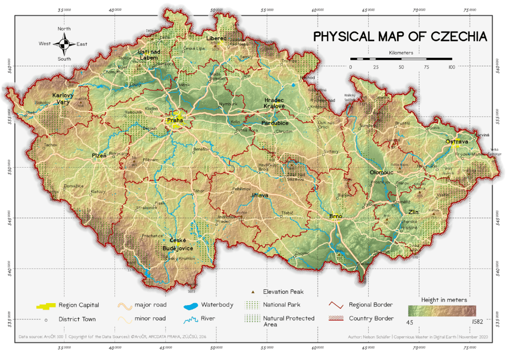
This map was created in the course Thematic Cartography in my third semester of CDE. Physical Maps are the best way to provide an complete overview on the characteristic features of a country. The main content of this map is the topographic baselayer, describing the elevation distribution with a coloured gradient, additional hillshade and labeled…
-
Thematic Maps with Graduated & Proportional Symbols

This set of maps was created in the course Thematic Cartography in my third semester of CDE. For this assignment, two thematic maps were created that show key figures of the population in the Czech Republic. The main objective was to understand the difference between graduated and proportional symbols in thematic cartography. I. Births and…
-
Map Posters

These maps were created in the courses Design in Geovisualization and Desktop Publishing in Cartography in my third semester of CDE. As a large number of providers on the Internet prove, it is a contemporary trend to hang up map posters in your own home. The design of such maps consists often of a simple…
-
Old Map Design
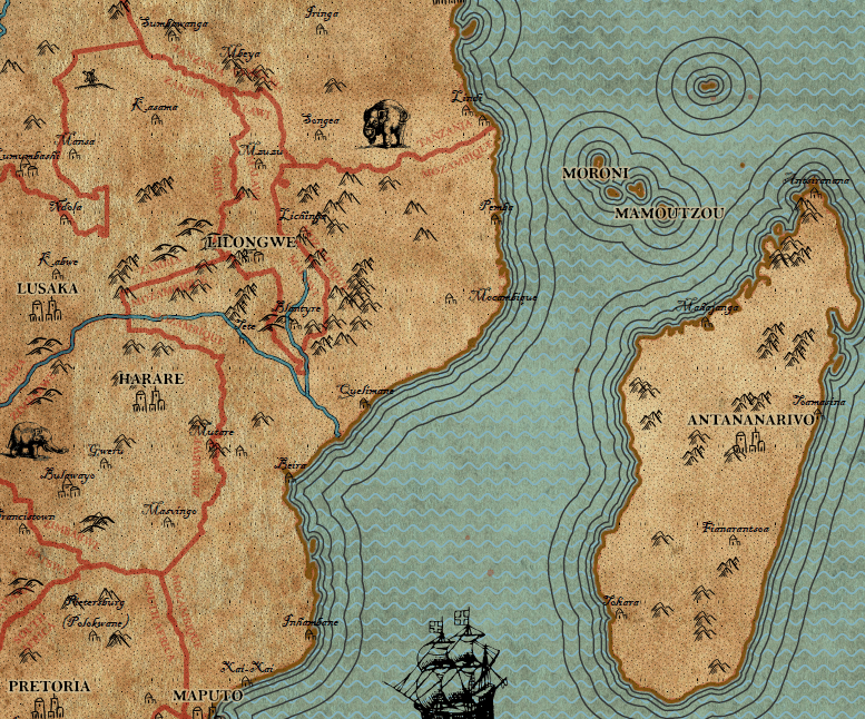
This map was created in the course Design in Geovisualization in my third semester of CDE. Following to a lecture on the history of cartography and the presentation of many old maps, an own map had to be created in the style of the vintage maps. With a given dataset of a part of Africa…
-
Choropleth Maps on the population of the Czech Republic
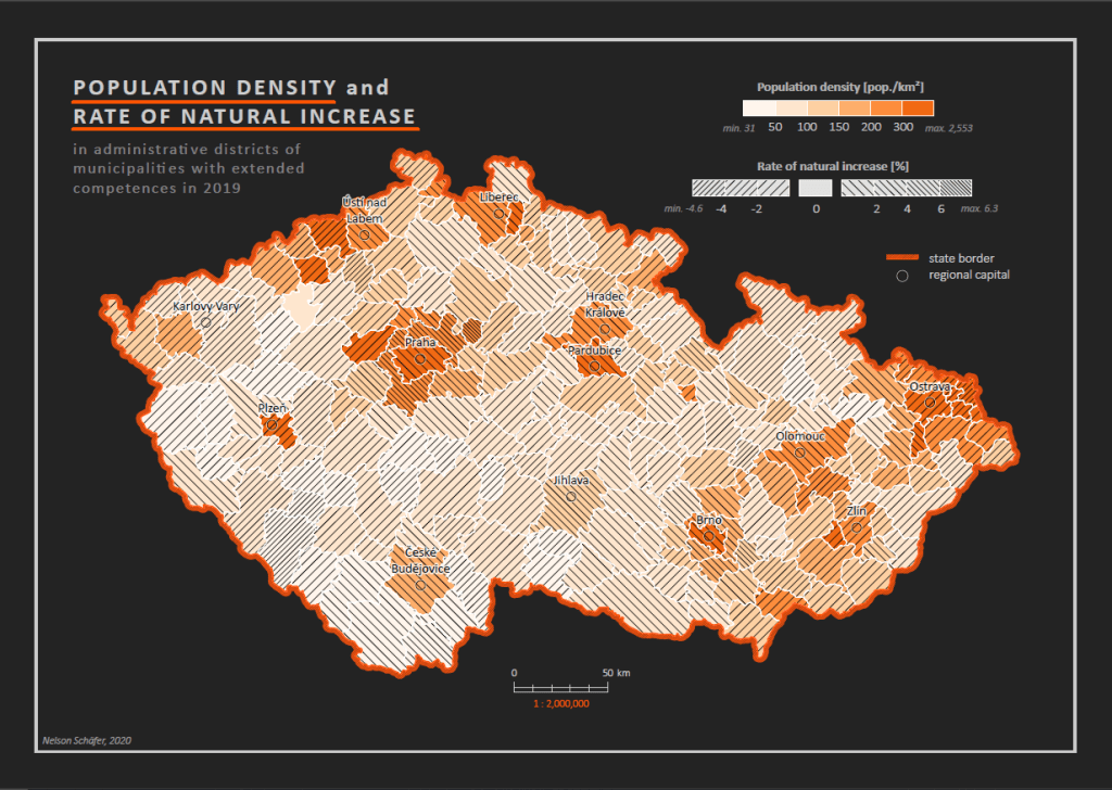
This set of maps was created in the course Thematic Cartography in my third semester of CDE. For this assignment, a number of thematic choropleth maps were created that show key figures of the population in the Czech Republic. The four maps show different methods how statistical data can be visualized and presented. Map 1:…
-
Bird Map of Smetanovy Sady
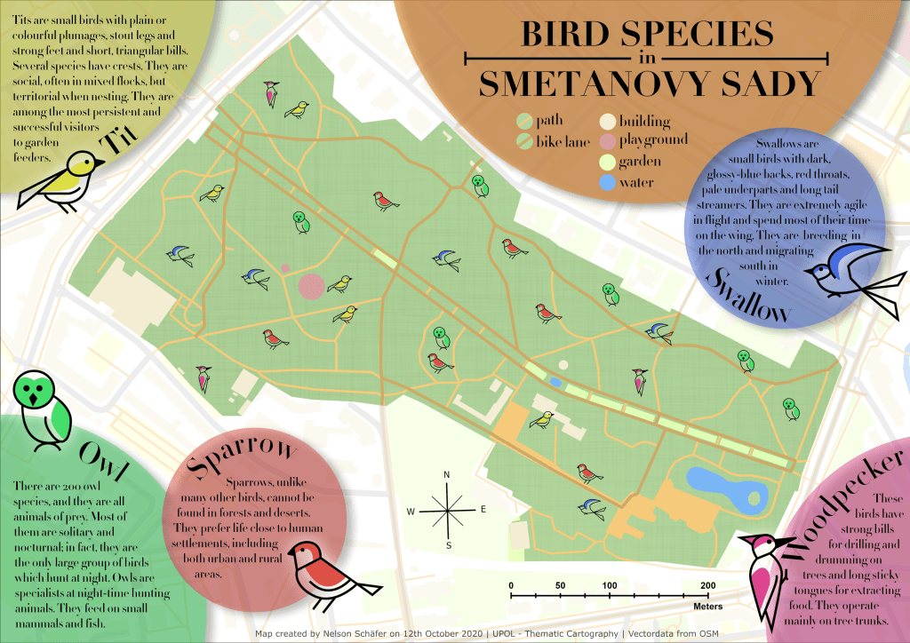
This map was created in the course Design in Geovisualization in my third semester of CDE. The idea of this project was to gain experience in designing a map that goes beyond the ordinary possibilities that are usually used in GIS software like ArcGIS Pro. For the fictional topic of bird species in a public…
