
Tag: Thematic Cartography
-
Poster about Me and my Home Country

This poster was created as the final project for the course Thematic Cartography in my third semester of CDE. For the final project of the Thematic Cartography course, the students were asked to use the skills they had acquired during the semester to independently create a poster from scratch. The poster had to include three…
-
Physical Map of Czechia
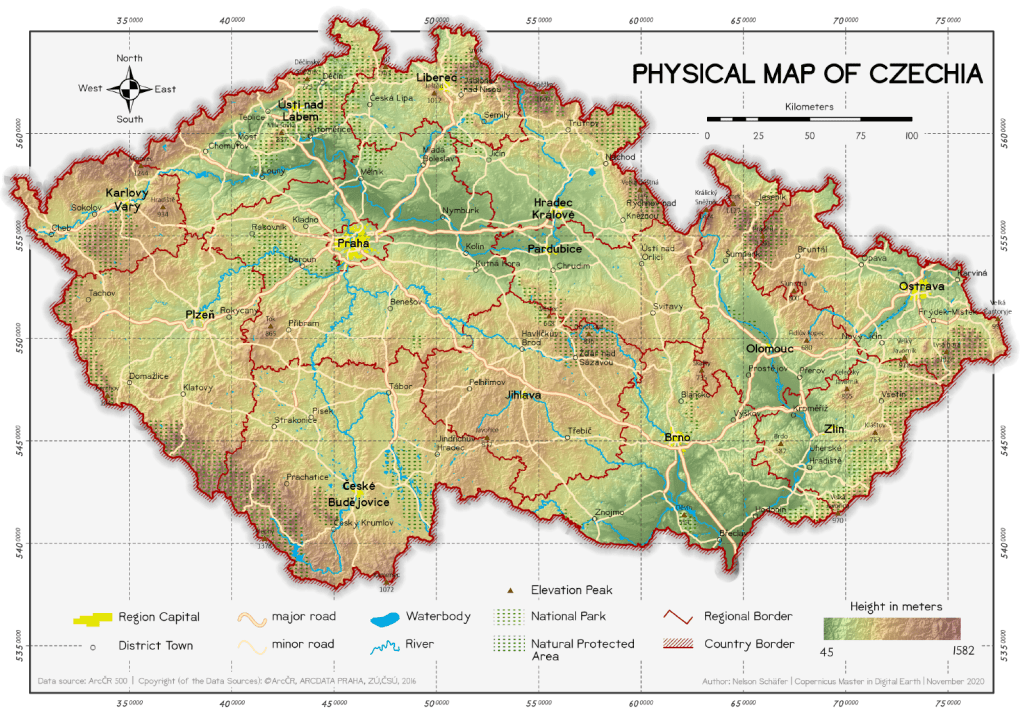
This map was created in the course Thematic Cartography in my third semester of CDE. Physical Maps are the best way to provide an complete overview on the characteristic features of a country. The main content of this map is the topographic baselayer, describing the elevation distribution with a coloured gradient, additional hillshade and labeled…
-
Thematic Maps with Graduated & Proportional Symbols

This set of maps was created in the course Thematic Cartography in my third semester of CDE. For this assignment, two thematic maps were created that show key figures of the population in the Czech Republic. The main objective was to understand the difference between graduated and proportional symbols in thematic cartography. I. Births and…
-
Choropleth Maps on the population of the Czech Republic
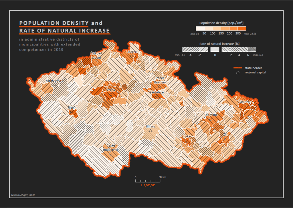
This set of maps was created in the course Thematic Cartography in my third semester of CDE. For this assignment, a number of thematic choropleth maps were created that show key figures of the population in the Czech Republic. The four maps show different methods how statistical data can be visualized and presented. Map 1:…
